Audiovisual and georeferenced records strengthen territorial monitoring in Tumucumaque Leste
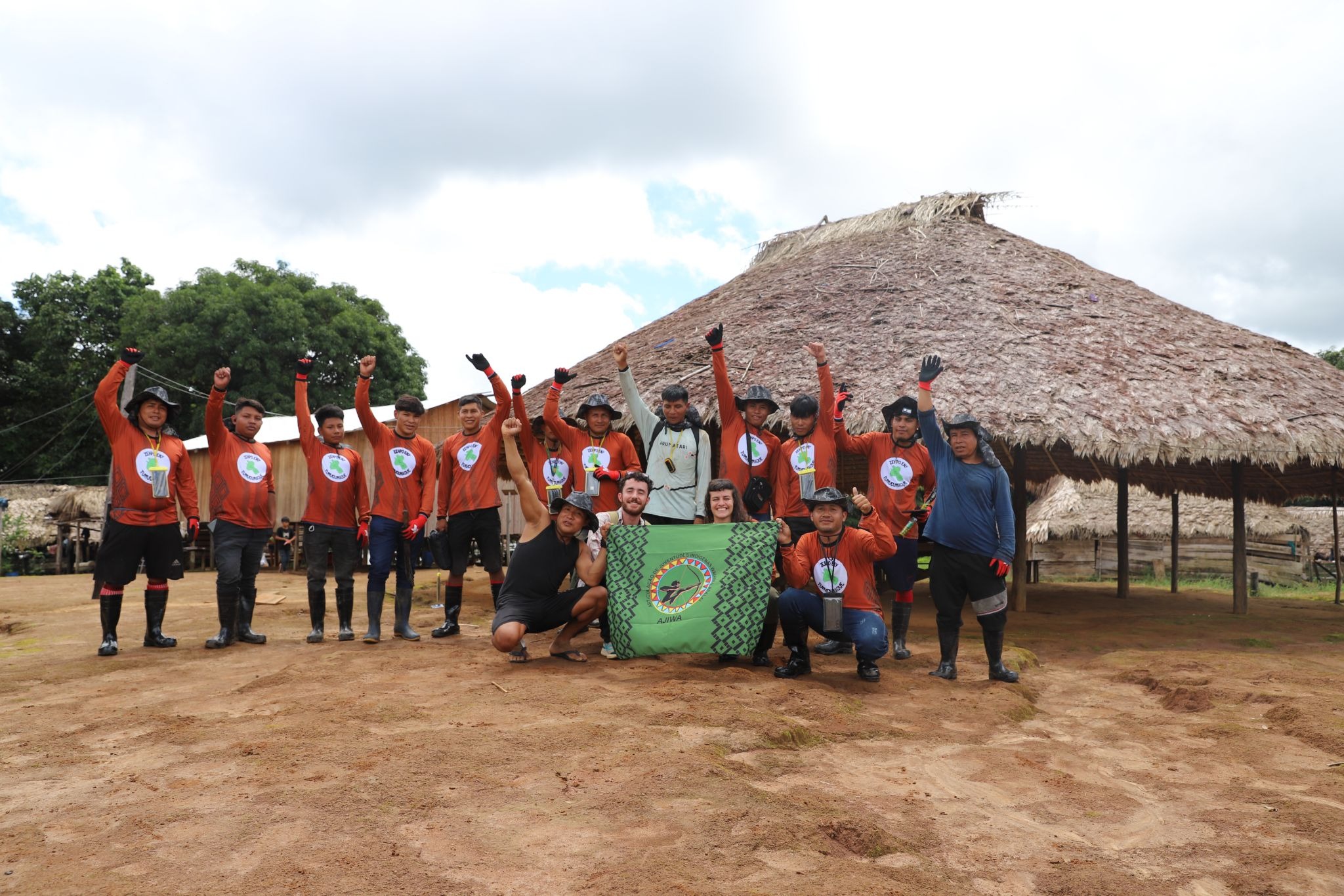
From May 20–24, 2026, Wayana, Aparai, Tiriyó, Akuriyó, and Katxuyana youth gathered in Matawaré village in the eastern Tumucumaque and Paru D'Este Indigenous Territories for an audiovisual and georeferenced recording workshop. Working with Iepé and Awana Digital, the youth updated a shared CoMapeo database of points of interest and began building a community-led historical record of the Zehpo Eny ("cave of bones"), with results soon to be published in Terrastories.
Cross-posted and translated from Iepé. Original link.
Audiovisual and georeferenced records strengthen monitoring in Tumucumaque Leste
During another workshop, young people combined different knowledge systems and technologies to update a database of points of interest in their territory.
Text: Angélica Queiroz
The Indigenous Information Recording and Monitoring Support (ARIMI) group during another training stage in Matawaré village (Photo: Iepé archive)
Points of interest for hunting, fishing, gathering, visitation, and sacred sites were mapped by Wayana, Aparai, Tiriyó, Akuriyó, and Katxuyana youth during another workshop on audiovisual and georeferenced recording, held between May 20 and 24, 2026 in Matawaré village, in the eastern region of the Parque do Tumucumaque and Rio Paru D’Este Indigenous Territories. The activity continues the training process in territorial monitoring models for the Indigenous Information Recording and Monitoring Support group (ARIMI), led by the Wayana and Aparai Indigenous Youth Articulation (AJIWA), which is linked to the Association of the Wayana and Aparai Indigenous Peoples (APIWA).
For one week, advisors from Iepé and a consultant from Awana Digital supported the young people in a range of activities, including the review of the database they began developing in 2025 — when the first workshop took place — and which they have continued to feed during their local monitoring expeditions. The CoMapeo application, developed by Awana, was used to collect georeferenced information. By the end of this dynamic, every participant had on their phone an up-to-date, shared database of records from the region.
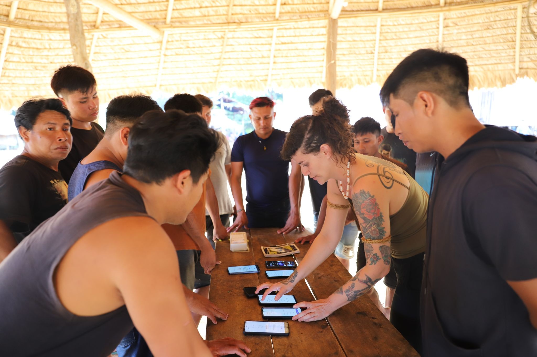
 Youth reviewed the use of the applications and updated their database (Photos: Iepé archive)
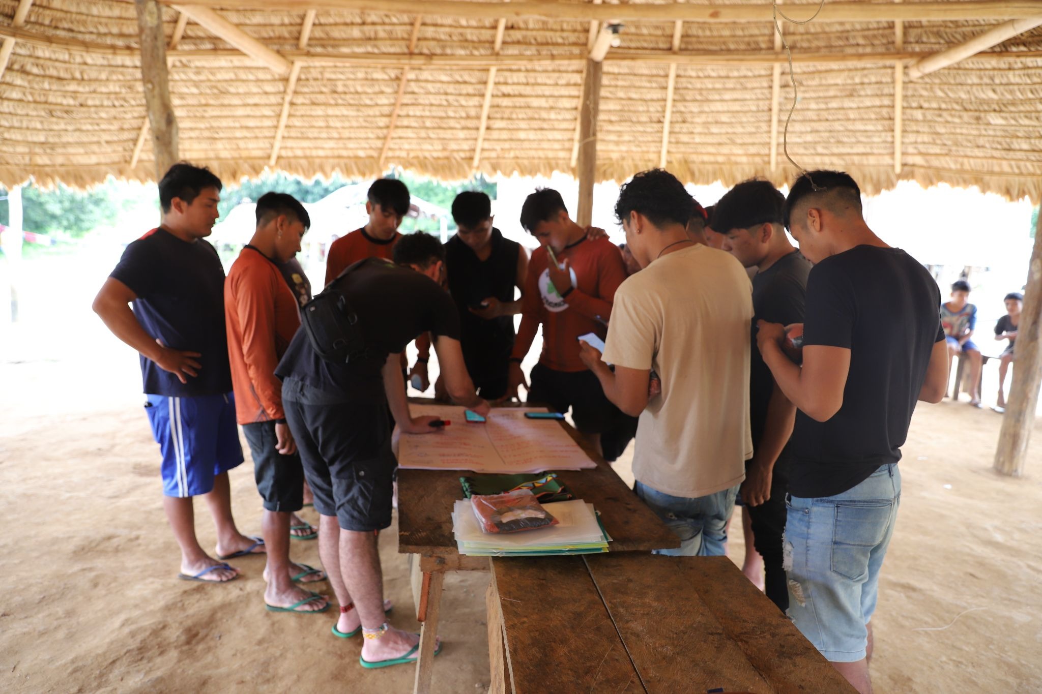
ARIMI work plans are developed through participatory and previously informed decision-making, in accordance with the group’s consultation protocol. The methodology values technological tools, but also local knowledge and practices — as well as the community’s own ways of transmitting and constructing knowledge, strengthened in everyday life and in the encounters between youth and elders, the greatest experts on the territory and on the places of interest to the community.
“The learnings and new information generated strengthen the creation of a participatory and adaptive monitoring system, always fed by the new information collected with the help of the applications” – Pedro Ribas, indigenist advisor at Iepé
According to Ribas, who is accompanying this training process, the goal is to strengthen monitoring practices capable of defining indicators that can generate reliable, low-cost information.
Hands-on activity helps build a historical record of a place of cultural and historical significance
Using georeferencing, digital, and audiovisual tools, the youth explored the surroundings of the Zehpo Eny or Yefë Ënï cave, which in the Aparai and Tiriyó languages, respectively, means “cave of bones.” The site holds great historical and cultural relevance and can be considered an archaeological burial site.
Throughout the activity, the youth gathered accounts from the elders of their villages, made audiovisual recordings of the conversations and walks, and took part in a discussion circle to present the studies developed during the training. From this process, they began building a historical record of the cave and its visitation from the perspective of the Indigenous communities themselves, strengthening a narrative that is constructed and legitimately recorded by the local population.
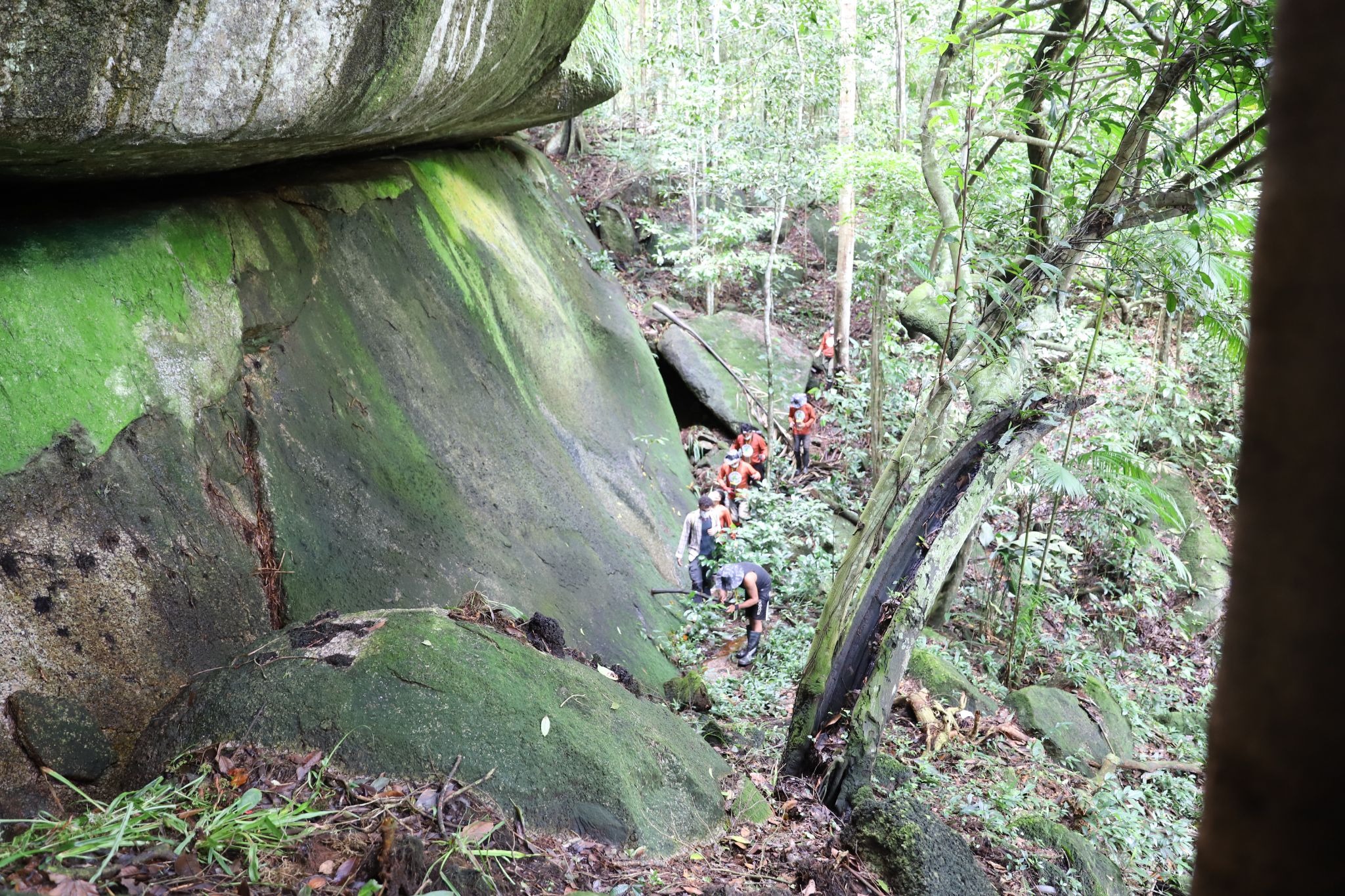
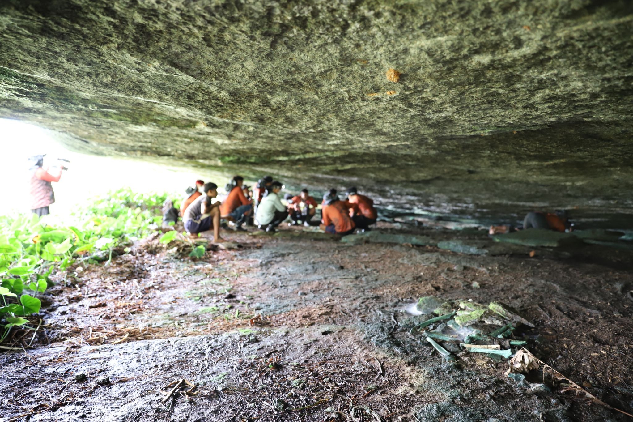 Records made by the Indigenous youth during the activity at the cave
Soon, the results will be accessible to the youth in the Terrastories application, where other records from previous activities are already shared. Terrastories is a geostorytelling application built to enable Indigenous and other local communities to locate and map their own oral storytelling traditions about places of great significance or value to them.
As the leaders present pointed out, it is in the community’s interest to record the histories and knowledge of their spaces. “Look, we are here and there is still much that is alive. My grandfather has already passed away, and he knew how to tell many stories — I myself know only a few. If I had known how to do what you are learning, I would have made recordings,” said Sepuku Tiriyó, chief of Matawaré village. Vice-chief Sinairi Tiriyó agreed: “What happened in the past we need to remember and write down. I would like to one day see a book to show my grandchildren. Our elders are leaving, and with them many stories die.”
Training was made possible thanks to recognition of the work
The training was made possible by the Indigenous Science Award from the Podáali Indigenous Fund, in which APIWA was honored in recognition of its research and training in territorial monitoring. Since 2025, the group has taken part in workshops aimed at strengthening participatory monitoring of the territory, supporting Indigenous youth themselves to act on the front line of territorial protection — one of the pillars of their Territorial and Environmental Management Plan (PGTA). They serve as technical support for the strategies already led by community leaders, combining technical knowledge and local wisdom in defense of the territory, always in articulation with governmental partners, such as Funai, and non-governmental ones, such as Iepé.
For Paty Paty Bob Marley Waiana Apalai, a young AJIWA leader and member of the ARIMI group, this information helps strengthen the struggle for the protection of the territory and the conservation of its natural resources. “We will keep working to support this pillar of our PGTA, but I feel that we have already advanced quite a lot,” she celebrated.
The activity was also supported by Nia Tero and the Bezos Earth Fund.