By Luandro Vieira. Cross-posted from the Digital Democracy blog.
Digital Democracy and Iepé, supported by Nia Tero and with remote assistance from Rudo Kemper of Conservation Metrics, recently collaborated on a series of intensive workshops aimed to support the Indigenous communities of the Tumucumaque and Paru D’Leste Indigenous Territories in the heart of the Brazilian Amazon, neighboring Suriname.
The goal of the workshop was clear: to empower community members with digital tools to record, protect, and share their rich cultural heritage and invaluable land knowledge, in response to the growing impact of colonialism.
Day 1: Neighboring brothers and sisters
The workshop kicked off with participants introducing each other, sharing the objectives of the Territory and Environment Management Plan (PGTA) and a dynamic to better learn about one another. We moved on with an exploration of digital applications and, we led an activity simulating the workings of the internet and data transmission. Participants represented data transmission points such as routers, satellites, and big tech cloud servers. This hands-on activity sparked engaging discussions about data ownership and privacy.

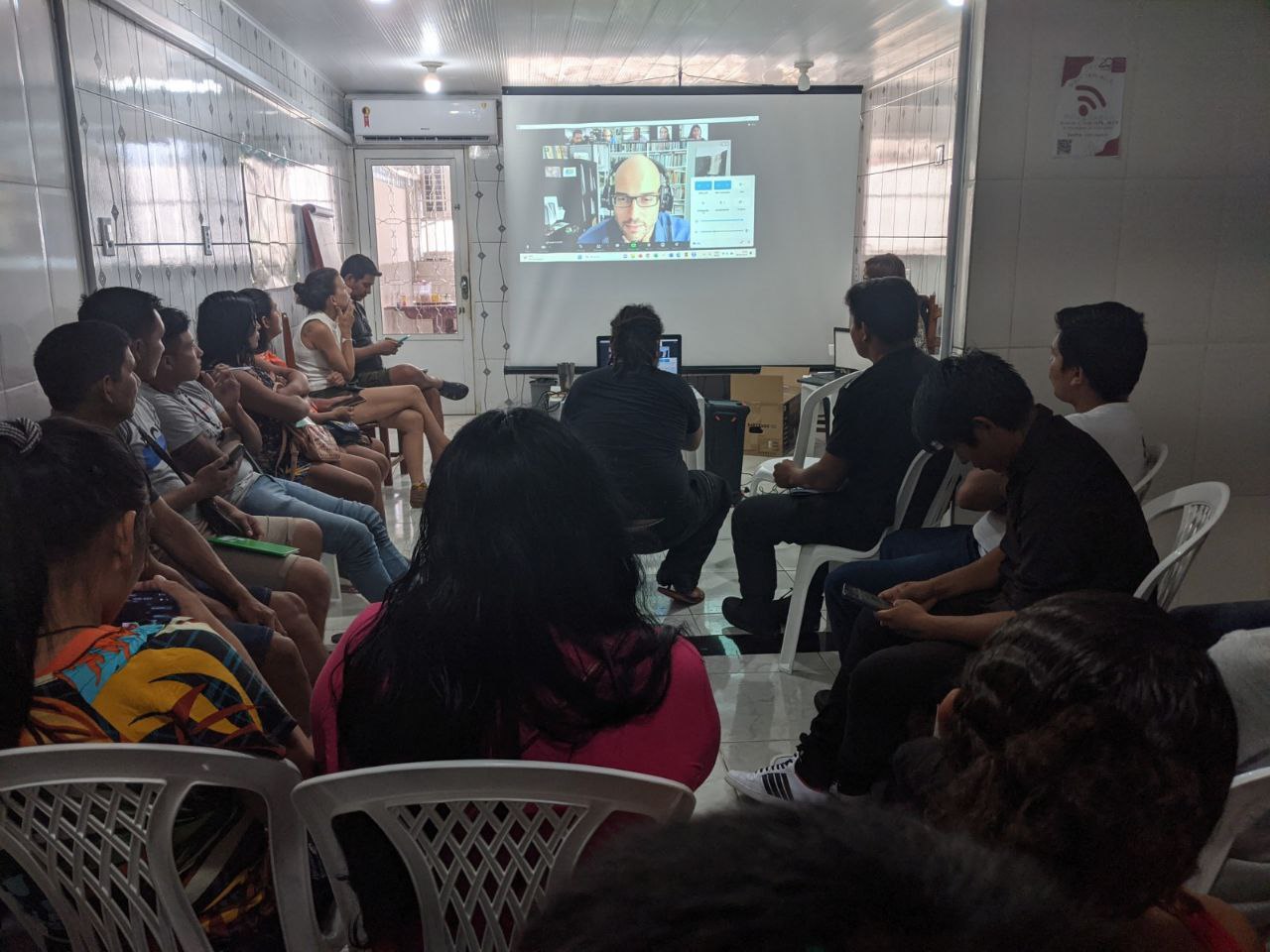
The afternoon session was enriched by a virtual meeting with the Wayana people from Suriname, who shared their experiences with their biocultural monitoring program. The Wayana People’s use of Terrastories to display their neighboring data left participants inspired and eager to delve deeper into the digital tools.
Following the event, the participants eagerly engaged in conversations via their workshop WhatsApp group. They shared messages and thoughts regarding the world of Big Tech, displaying a newfound depth of interest and knowledge about the digital realm.
Day 2: Mapping Territories with Mapeo
Several participants already had experience with Mapeo, and they managed to amass an impressive database of observations using the default configuration and minimal assistance from our team. (Here the result of our first practice exercise with Mapeo)
During the second day, the participants practiced synchronizing the data they had collected as a task after the workshop hours, using Mapeo. Additionally, they delved into the captivating visualization of Macapá’s map, which showcased the various data points collected from different areas of the city. This exercise was useful to show the richness of mapping as a tool to comprehensively understand territories.

The participants delved into mapping categories and their settings, using specific icons and translations into the Apalai, Wayana, Tiriyó and Katxuyana languages. While some translated, others dedicated themselves to creating drawings for the different categories. To enhance participants’ understanding and ignite their creativity, we presented many examples of custom settings and custom background maps. The maps integrated data layers with valuable information on threats, biodiversity and political boundaries.
Aventino, president of local indigenous organization, Apitikatxi – Tiriyo, Katxuyana e Tikiyana Indigenous Peoples Association, shared:
“Mapeo appeared to solve our need to find an application that we could use to gather evaluation data for the PGTA, and we are looking for more tools to help us map. We need more information on our maps, like sacred sites, there’s lots we can document.”
Day 3: Visualizing Oral Histories with Terrastories

On the third day, we focused on Terrastories, a remarkable tool we support at Digital Democracy. Terrastories is a tool for communities to visually document their oral histories and traditional knowledge in a geographically meaningful way.
Participants looked into their archived drawings and geo-points, printed the drawings, and wrote stories in their languages. They used a KoboToolbox form to gather information about the places, the speakers, and the audio story itself. By the end of the day, they had a rich tapestry of places and stories in all four languages displayed on the Terrastories interface.

One participant shared a story about a sacred site where their ancestors performed rituals, while another narrated a tale about a river that had been a source of sustenance for their community for generations. This process of storytelling not only allowed the participants to document their cultural heritage but also fostered a deeper understanding of their territories.
Day 4: Reflecting and Looking Ahead
The final day began with revisiting the stories from the day before. Participants made adjustments and shared their experiences. The discussions were rich and insightful, reflecting on the importance of what they had learned and how they could apply these tools in their communities. Participants agreed that these tools would be instrumental in preserving their cultural heritage and sharing it with future generations. Differing ideas for implementing the tools were shared, and all agreed on the need for ongoing training and support.
Aventino shared his thoughts:
“The more information we have on the maps, we realize that it is not just Indigenous land, it is not just a place where people live: it is a sacred place, where there are many important things to be recorded, many things need to be seen. The participation of youth is important because not only do they learn to monitor and map their territory, but they begin to understand the history of that place, because many young people here do not know the history of each place that exists. Why does it have this name? Who gave this name to that region, to that place we call sacred, why is it sacred? I believe that Mapeo will bring a lot of this, we will map sacred places, new villages, norms and in short, various information that will be important to present the territory in which we live. It is a territory that we should know, the youth should be well aware of their territory and say that it is a sacred place that will be preserved.”

Another participant mentioned:
“I do this part of youth coordination, helping to gather these young people who are starting to scatter. Many are leaving the villages because they do not have other opportunities to have something that catches their attention. I believe that these technologies that are emerging today, not only they are good, but they are a means to improve the coordination of youth. So, we will have the Mapeo of young people, we will have them on the expedition, exploring technology and presenting maps of the territory. This is important.”

The workshop was hopefully a step towards support these remote communities in their process to harness their cultural richness and translate it into the digital age. The participants’ level of engagement and enthusiasm shows the potential of these tools to support Indigenous communities like these ones, foster cultural preservation, and actively engage the youth in their traditions and ancestral lands. By providing appropriate training and practice, tools have the power to support communities to reclaim their narratives and actively preserve their rich cultural heritage.